Fadgen's Adventures

Fadgen's Adventures
Green Creek Lake

Monday, October 24, 2016

City of Rocks/Castle Rocks

Last weekend, Tamara and I joined John Platt and Brian Mahon for a weekend of rock climbing in SE Idaho.  We met up Friday night at the home of one of John's old friends outside Castle Rock State Park, Tom Harper and Hannah North.  They both have climbed through out the City of Rocks and Castle Rocks over the years, and we were excited to be with them at their home in the middle of nowhere.

After a relaxing Saturday morning, we made the short 15 minute hike from the house to Caste Rock.  Hannah took us to the south face of Castle Rock   https://www.mountainproject.com/v/castle-rock---south-face/105821826, where we could set up a couple of top ropes allowing the six of us to spread out a bit.

Me leading Little Time


Tamara heading up Little Time
Tamara likes this slab climbing
John showing us how to hold a beer after climbing all day
A crew around me on Castle Keep
High stepping on the first friction move on Castle Keep
John, Tom, Hannah and Brian looking back at the south face of Castle Rock
 After climbing four routes on the south face, Hannah took us around to an alcove on the west side of Castle Rock for a couple of other 5.7 routes on the Egg Wall.  Before we realized it, we had climbed the day away, and it was time to head back to the house.

With the weather looking good, we decided to head over to the City Sunday morning to climb a four pitch route called Theater of Shadows on Jackson's Thumb.  https://www.mountainproject.com/v/theater-of-shadows/105741557

With six of us climbing, we split into two rope teams of three.  Hannah, John and Brian made up the first team, while Tom, Tamara and I were on the second team.
Theater of Shadows (to the left of the large rock)
Making the 45 minute hike to the route
Hannah and Brian getting ready
Brian leading the first pitch
John following Brian
Tamara following me up the first pitch

Tom leading the second pitch
Tamara following after the excellent third pitch
All smiles while hanging on the 3rd belay station
 Tom and I switched leads on Theater of Shadows with Tamara hauling up the second rope in the middle.  After reaching the top, we had a couple of rappels to make to get down to where we could walk out.   Tamara, who hasn't had much (or rather any) experience rappelling (http://fadgenfamily.blogspot.com/2014/10/city-of-rocks.html) , enjoyed the free hanging rappel off the top.  Actually, Tom had her on belay for this and she was completely safe.

Tamara on the free hanging rappel
After this most excellent climbing route, we headed back to the house.  Here Tamara and I bid John, Brian, Hannah and Tom farewell and headed back to Boise.  John and Brian had a couple more days of climbing in them.  John's trip report is here: http://www.splattski.com/2016/city_grays/index.html


Monday, September 26, 2016

Idaho Summits Fall Outing - Little Kane Peak


After countless hours discussing dates and locations, the IS outing committee decided on Little Kane Peak, in the Wildhorse Basin of the Pioneer Mtns, for this year's fall outing.  At 10,184 feet and a trail leading up to the main ridge, this peak appeared family friendly.  So 4/5ths of the Fadgen family joined 13 other hikers Saturday morning for a day in the mountains.
Old Hyndman Peak
Mustang Peak - Sunday's planned climb
The rain that passed through the area Friday afternoon left a nice dusting of snow above 9000 feet.  In the brilliant morning sunshine, this snow made the mountain views pop!

Immediately after leaving the parking area we faced our first obstacle - crossing Wildhorse creek.  Though Dan offered to carry anyone across the creek the night before, no one took him up on his offer.  Some of us used sandals to cross, others removed boots and crossed in bare feet, and one just said screw it and walked across while water poured into his boots.  There is nothing like your feet feeling like blocks of ice first thing in the morning!
Early morning creek crossing


Our first view of Devil's Bedsted East
Once across the creek, the group started up Boulder Creek trail chatting in small groups.  After a couple of miles on this well groomed trail, we broke out of the forest and found a spot to easily cross Boulder Creek.  Once out of the trees, it was hard not to trip while gawking at the surrounding mountain views.  We continued on the snow covered trail that switched backed and forth across the mountain face, eventually leading us to the summit ridge.


Oleg and Olga crossing Boulder Creek
After a break in the windless sunshine on the ridge, the group split up.  Six of the guys went left to tag Purgatory Peak (10,942'), while Dan, Bruce, the ladies and I opted to go right toward Little Kane Peak. We all traveled along the ridge top in the warm sunshine.

Heading towards Purgatory Peak


Other than a group of rocks that required us to drop down to the left, the going was relatively easy in the 3-4" of now slushy snow.  After about a mile of ridge walking with no elevation gain, we finally came to the final 1/4 mile and 300 feet to the summit arriving around 2PM.  The views were phenomenal, especially since we were in short sleeves!
View from top

In another 30 minutes, the six that had climbed Purgatory started trickling in led by Dylan.  Eventually the whole group was together again, and after Dan did his obligatory group summit shot we started down.  In honor of Splattski, who opted not to join us and missed out on a fantastic day, we decided to make the hike into a loop by dropping off the NE ridge towards Point 8972.

Dylan led the group down the steep section until we gained a flat, open ridge.  After a bit the group again split up, with Mark, Dylan and I heading towards Point 8972, while the other 10 searched for a gentle way to the valley floor.  With the snow up high thwarting our Sunday plan of climbing the Broken Arrow Arete, we wanted to get an up close look at our plan B - Point 8972.
Rocky Point 8972

Unfortunately, the rock quality left something to be desired.  A little depressed by our Plan B falling apart, we did our best to scree ski down (including Shadow) to the valley floor.  Once down, we cruised up the valley in time to meet the others for the Wildhorse Creek crossing.
Dylan picking up some wood for the evening

About half the group stuck around for Saturday night, enjoying cocktails and conversation on a beautiful clear cold night.  Sunday morning, the Fadgen's elected to head home (too much to do before traveling Monday) while the others went off to climb White Mountain (http://idahosummits.com/trip_reports/trip_report.php?trip_id=199).

Another great Idaho Summits Outing - excellent weather, great location and fantastic friends!

Friday, August 12, 2016

Mt Idaho - 12,065 feet and Mt. Morrison 11,367 feet


Mt. Idaho
I'm on the 10 year plan for completing Idaho's nine peaks at about 12,000 feet - the so called "12'ers".  Dylan and I started this quest back in 2009 by climbing Mt. Borah  ( http://fadgenfamily.blogspot.com/2009_09_01_archive.html ).  The last 12'er I completed, Mt Leatherman, I have done twice ( http://fadgenfamily.blogspot.com/2013/08/leatherman-peak-12230-feet.html and http://fadgenfamily.blogspot.com/2016/06/leatherman-peak-12228-ski.html ). With time running out on my ten year time frame, I met up with my buddy, Steve Mandella, Sunday evening to climb Mt Idaho, Idaho's 7th highest peak.

We caught up with each other while enjoying a great dinner of T-Bone steaks, sweet potato and apple hash, blackberry pie and a couple of beers.  With full bellies, it wasn't too difficult to turn in early for our 5AM wake up. 

We parked at Elkhorn Creek and were walking up the trail at 6:15AM.  It was looking like it was going to be a gorgeous day, cool, sunny and little wind.  The trails winds through the sagebrush, before stating the uphill grind through the trees. 


Peak 11,967
We were making good time in the shade, progressing upward at 1500' per hour all the while enjoying the views in the Elkhorn Creek cirque.  After a couple of hours, we broke out into the sunshine at about 10K feet and took an extended break.  Staring us in the face was the scree slope leading to the west face of Mt Idaho.
Eastern slope of Mt Morrison
Steve heading up
Mt Morrison (left)
Breaking out into the sunshine
Mt Idaho
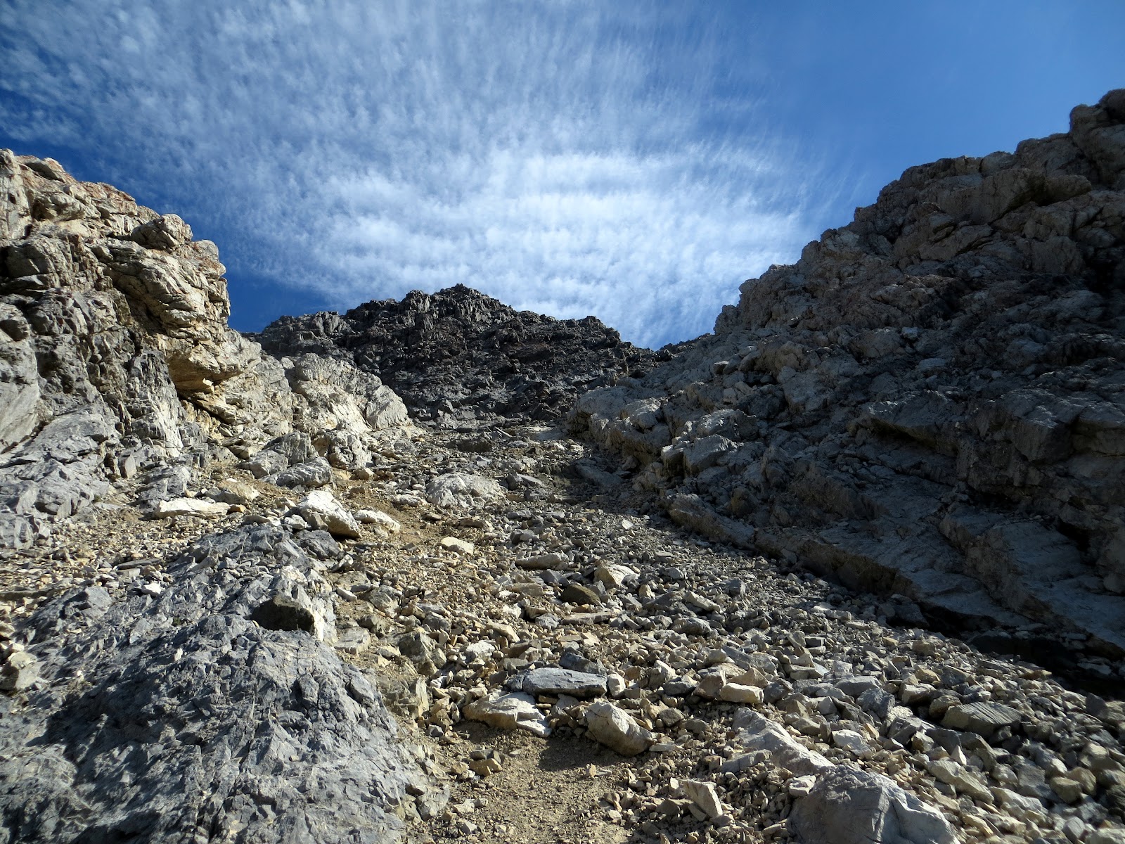
We followed the trail through the scree, seen above, until we reached a section of white rock, where we obtained the ridge.

Unknown to us, the trail split at this ridge and we mistakenly took the right fork. We probably didn't see the left turn that went over the ridge due to it being in the shade.  As we were crossing the class 3+ rock seen in the picture below, I kept thinking that we were off trail.  But, someone had left a large walking stick (Brett maybe?), so we kept moving along.  It was't until the descent that we found the correct (easier) route.

Don't go this way!
Back on trail
We followed the trail until we reached the west face and here we split up.  Steve took the semi-solid rock to the left side while I took the right.  This allowed us to move up without worrying about kicking rocks on each other.
Loose, rocky west face
Steve almost to the summit
We scrambled up without much difficulty and reached the top at 10:45, 4.5 hours after we had started.  This was Steve's 9th and final Idaho 12'er and my 7th.  The views from the summit did not disappoint, with Mount Borah standing tall and proud just to our north. 

Mt Borah
We took a nice break on top of Mt Idaho, surveying the surroundings, while fueling up for the next objective, Mt. Morrison.  
Ridge from Mt. Idaho to Mt. Morrison
Mt. Idaho summit Splattski
With our mojo rising, we did our best at boot skiing our way down the loose rocks on the face of Mt. Idaho.  We traversed across the ridge, this time correcting the error made on the ascent in the white rock section, before obtaining the connecting ridge to Mt. Morrison.
Steve dropping off of Mt. Idaho
It's only "over there"
Close up of Mt. Morrison
The first obstacle on the ridge was a gnarly looking rock outcropping.  Rather than go up and over this, we decided to drop down 300 feet or so and traverse below it.  The going down part wasn't too bad, but the traverse was pretty loose, and it was starting to heat up a bit.  Once around the outcropping, we then had to go back up the 300 feet that we had previously lost.  I was having second thoughts at this point, but since it was my idea to add this peak for the day, I applied Rule #5.

Steve on the way back up after crossing below the rock outcropping
Back on the ridge with Mt. Idaho on the left
Once around the outcropping, we had a real good look at Mt. Morrison, and it wasn't going to be a simple walk-up.
The summit is back there somewhere
The fun was just beginning!  We would move over one section of the rocky ridge only to encounter a drop off that we didn't feel comfortable negotiating.  No worries, just down climb a bit, search for a natural ledge to skirt this sketchy section, and repeat as necessary. We picked our way up and around for the next half  hour before the actual summit came into view.  All the while I was humming Doors tunes!

Steve just about getting blown over while heading for the summit of Morrison
Mt. Morrison summit Splattski
After all the route finding and class 3 scrambling, we were pretty happy to be on the summit of this peak, We didn't linger though, as the wind was howling, and the clouds were building.  Neither one of us wanted to retrace our steps, so we moved down the Southwest ridge hoping to find an easy way down.


No such luck, this pile of rubble, called Mt. Morrison, wan't going to go easy.  We picked our way down the loose rock for close to a 1000 feet before we could get in some scree small enough to allow us to boot ski a little.  
Cool rock formation on the SW ridge 
Steve picking his way down
After another 1000 feet of descent we finally hit the trail at 9K feet.  Only another 2K of hiking and we were back at the truck enjoying a couple of large, cold beers!
Looking back up our descent route
I'd like to thank Steve for the opportunity to put in a big day.  These other obscure peaks are so close to the more popular peaks and are usually a lot more fun.  Great day!

Stats:
Time: 10.5 hours car to car
Distance: ~8 miles
Elevation: 5800 feet


Blog Archive

Followers