Fadgen's Adventures

Fadgen's Adventures
Green Creek Lake

Monday, August 12, 2013

Leatherman Peak - 12,230 Feet


Leatherman Peak on the left
At the Outdoor Idaho climb in the Lemhis last month, Sherpa Steve Mandella mentioned that he wanted to climb Leatherman this summer.  Last week we messaged back and forth before settling on Monday, August 12, to go for it.  I took off a day off from work and left from Boise in the smoke and haze, while Steve left from Pocatello in clear skies.

We decided to make the trip a little easier on us and met at Amy Lou's Steakhouse in Mackey for dinner, before starting the hell that they call a road to the West Fork of the Pashimeroi.  After a two hour grind, through a road similar to the one to Hell Roaring Lake road, we arrived at the trailhead, quickly setup camp, and opened a beer.

The alarm sounded early at 5AM, but after a quick cup of coffee and something to eat, we were off on the Leatherman Pass trail at 6 in the early morning chill.  Our plan was to follow Dan's route: http://www.idahosummits.com/leatherman/leatherman.htm and make any necessary changes as the conditions allowed.

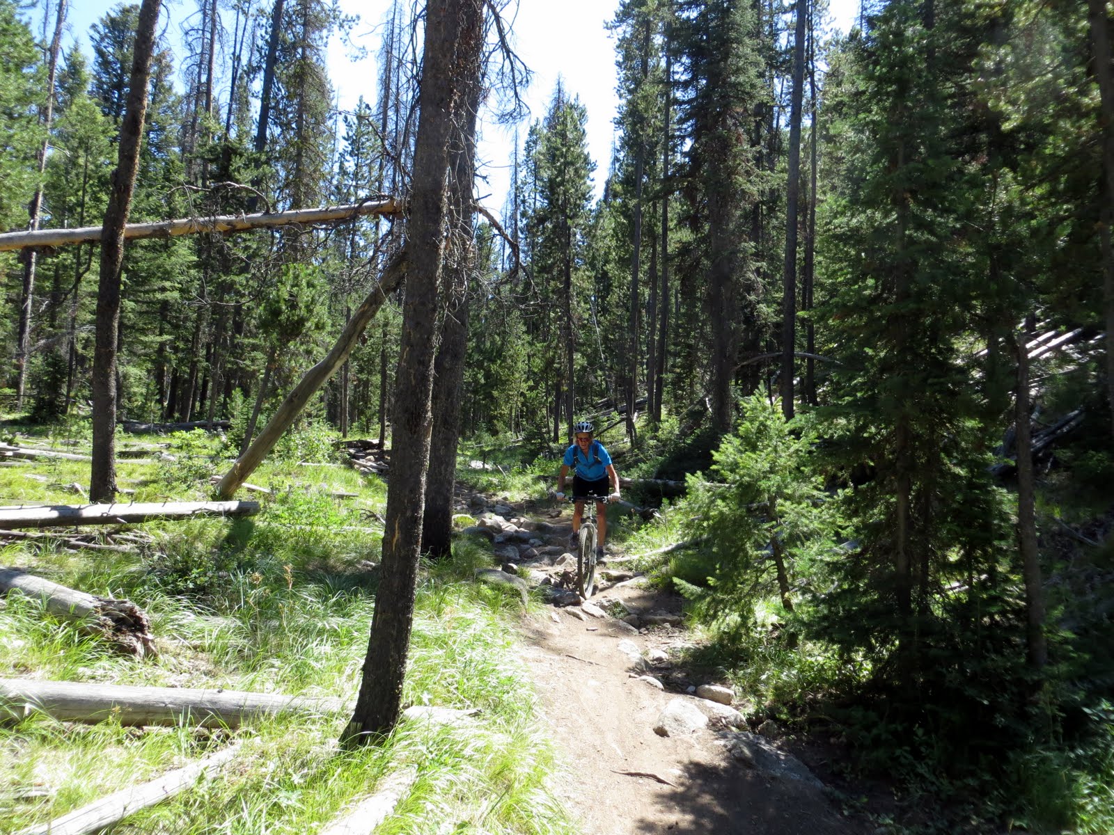
We made quick work of the trail portion, passing quickly through the trees and small meadows until we popped out into the gorgeous upper meadow.  After being in smoke filled Boise, the scenery really stood out vibrantly in the early morning sunshine.
 
From the upper meadow at 9200 feet we could see the path that Dan described headed up through the talus. Looked like a goat trail, zigzagging straight up.  We initially headed up this trail, but the rock was extremely loose, so we headed climbers right in search of more solid footing.  The right side, or the North ridge, looked steep, but definitely within our abilities.

As we progressed up to the cirque at 10,800 feet, we continued to move right and obtained the North ridge, which now didn't look too steep from this elevation.  Turned out to be a great move.  We completely bypassed the loose scree on the "trail" in favor of solid footing interspersed with just enough loose rock to keep the blood flowing.  Unfortunately for me, this rock was also very sharp and guess who forgot gloves?
Steve M Photo
Halfway up the North ridge looking down.
North ridge
In short order, we were high fiving on the summit at 9:30.  The views were spectacular!
Pass Lake
West Fork of the Pashimeroi
Summit Spattski!
It was a bit windy and chilly on top, but we sat up on Idaho's second tallest peak speculating on the names of all the peaks around us.  We should have known them all.  But....  After a leisurely lunch, the  wind started picking up and the clouds started moving in, so we figured it was time to head down.
Bad Rock Peak
Mount Borah
We followed the "trail" down hoping for an easy descent.
Steve starting the descent

The trip down was uneventful, a bit of scree skiing intermixed with trying to maintain our footing without falling on the jumbled rocks.  In an hour we were back at the upper meadow where Steve set a fast pace back to camp.  I did my best to stay on his heels.

One last look


Once back at camp, Steve had some special Back Country Scottish Ale from Lewis and Clark Brewery waiting on ice.  Since it was quarter past noon, we each had a cold one - and they were great!

Stats:
Distance: 8 Miles
Elevation: Approximately 4100 feet
Time: Summit - 3.5 hours, Car-Car - 6.25 hours

Sunday, August 4, 2013

Sawtooth Mountain Biking

Tamara and I have been doing a bit of mountain biking up in the Boise Foothills this summer, she more so than me.  Saturday morning we headed north on the three hour drive to Stanley.  Our plan was to cycle the Fisher/Williams Creek loop followed by the Elk Meadows/Stanley Lake Loop trail.

The temps were hovering in the mid 50's as we arrived at the near full Williams Creek trailhead parking lot around 10AM. After conversing with some riders from the San Francisco Bay area, we saddled up and headed down Highway 75 for the short two mile ride to Fisher Creek Road.  Along the way we dodged the inevitable jacked up 4x4 pickup truck pulling the monster trailers screaming down the highway.

Another two mile stretch of gravel road took us into a two track that followed Fisher Creek through willows, aspens and living pines.

Soon we entered the burn area and started the gradual climb.
Tam fueling up.
We did this loop last summer and struggled up the steep rocky section just before the summit.  This year we cruised up it without too many difficulties.  Once on top it was time for some sweet smooth single-track!
 
Even though we had an almost full parking lot we only saw about a half dozen other people on the trail - nice!  We completed this 13 mile loop in a little over 2.5 hours and then packed up for the short drive to Stanley Lake for a short lunch break.  After fueling up, we were off on the next loop.
 
Our version of the Elk Meadows Loop started with a two mile run up the Stanley Lake road followed by another 2 mile grunt up the gravel Elk Mountain road.  At this point the weather was heating up (mid 70's still!) and our legs were feeling the lactic acid build up, but we pushed through to the trail head. 
Tam almost to the trailhead with McGown Peak in the background.
The guide book says that the single track trail includes "lots of baby head shaped rocks" and that caution should be exercised.  There were definitely baby sized head rocks all over the place.  These combined with large tree roots and an occasional downed tree provided a great technical ride contrasting the smoother Fisher/Williams Loop.

After a couple miles of rocky rutty single track we dropped out onto Elk Meadows where we cruised on smooth single track with an occasional mud hole thrown in to keep you awake.
 
The trail then gradually rose up the flank of Elk Mountain, past an old mine, and entered another large meadow that offered spectacular views of the Northern Sawtooths.
 

After this meadow it was back to a two track/gravel road for the bumpy ride back down into the Stanley Lake basin.  This 12 mile loop took us 2 hours to complete.  It was 4PM and we were spent.

There was a lot of sighing on the drive back into Boise.  What a day!

Thursday, August 1, 2013

Hiking Around Bozeman with Taylor


Over the last few years this blog has been mainly the John and Dylan show with an occasional Tamara sighting. The fourth member of the family, Taylor has pointed this out to me on several occasions. This past weekend was her time to finally be included!

I travelled over to Bozeman on Thursday night and stopped at an old friend’s house for beers, an excellent steak and a place to sleep.  Friday morning I was again on the road, arriving in Bozeman in the early afternoon.

After heading to the local sporting goods stores, looking for deals, I suggested  we float the river.  Taylor jumped at the chance.  After gathering a couple of inner tubes, we were on the water of the Madison River in 90 degree sunshine enjoying the two hour float.  Unfortunately I left the camera in the car.

 Our plan Saturday morning was to head up to Lava Lake for an overnight backpacking trip.  The Lava Lake trail is a “popular” trail just south of Big Sky, that takes you into the Lee Metcalf Wilderness Area.  We were off at the crack of 8AM for breakfast at our favorite bakery in Four Corners, followed by the short drive to the trailhead.

 
The hike up the 3 mile trail wasn’t too bad – not too steep, plus we had cloud cover most of the way.  We caught a glimpse of a moose cow and calf(s) before we ran into the two guys that scared them.  Luckily, the moose were interested in getting away rather than confronting the humans.

In a little less than two hours we were at Lava Lake where the skies were a bit hazy from fires near Missoula, as well as some cloud cover.   We lounged around the outlet for a while before setting up camp in a semi-secluded spot – or so we thought.  During the course of the afternoon we probably saw 40 other people and had at least a dozen walk through our camp!  When the Montana trail guide book says popular it really means crowded, especially by Idaho standards. 

During the course of the hike, Taylor amazed me with all her knowledge of parasites and bacteria as well as the description of the harm they will do to your body.  Glad I went into engineering...
 
Taylor ready to get rid of her pack.
 

Lava Lake
My plan was to hit a peak nearby called Jumbo Mountain, but with no trail and thick brush, we decided to take a stroll up to another mountain called Table Mountain.  This one actually had a trail. Once camp was set up, we started hiking up the Table Mountain trail, but as we progressed the overcast skies started spitting rain.  So, we headed back down.  After a mile or so, the temperature started dropping as the rain and wind picked up forcing us into the tent where we enjoyed some quality reading time. 

Pikas!  They were all over the place.


Frustrated by the cold and rain and it only being 5PM, I offered up the option of packing up and heading back down.  I figured we could relax and hike somewhere on else Sunday.  After some thought, Taylor agreed.  What really made up my mind was the fact that someone had grabbed my flask of wine that I had chilling in the lake.

Once we had a break in the rain, we quickly packed up and scooted down the trail back to the car.  Of course as we drove away the skies behind us cleared – oh well.  That night in Taylor's apartment we cooked up our planned dinner for the night - ”In The Wild Chef” Lemon Ginger Chicken with couscous.  Turned out to be excellent!

With slightly sore legs from the 8 miles we hiked the day before; we woke up at our own pace, had breakfast and then headed out to Hyalite Canyon.  Taylor has wanted to take us out to this Bozeman gem for the last couple of years, but we have always had other plans.  The Hyalite Canyon trail takes you past a half dozen or so waterfalls until you reach Hyalite Lake at 5.5 miles.  It continues on another couple of miles and tops out at Hyalite Peak.  Our plan wasn't this ambitious though.

We luckily found a place in the parking lot (do all the people of Bozeman hike?) and headed out with nothing but our water bottles and cameras.  We bypassed the first falls (Grotto), since Taylor figured that this is where the majority of the people would be and headed on up to Arch Falls.  Arch Falls apparently has an arch that allows the water to flow through; unfortunately we were above the arch and couldn’t see it.

Looking down Arch Falls
The next set of falls, which were another ½ mile up the trail, are called Silken Skein Falls.  The side trail to these falls was a short steep grunt up several hundred feet before reaching this beautiful and secluded place.
 
 
Another waterfall across the canyon from Silken Skein Falls
After snapping a few photos, we both mentioned that our stomachs were growling.  Time to head back.  Along the way back down we stopped at Grotto Falls to witness another great sight of water falling down a cliff.  We headed back to Bozeman, where Taylor took me to Burger Bob's for great burgers and chocolate shakes!
 
All in all, a great weekend spent with my lovely daughter Taylor - can't wait to do it again!

This trip got me thinking of all the other backpacking trips we have taken over the years.  Here is a photo when she wasn't so independent.

A blast from the past! Our 2004 hiking trip to Coffee Cup Lake!

Blog Archive

Followers