Sometimes it's just the little things that matter.
During our trip to Glacier Peak last year, John, Michael, Brian and I chose Mount Olympus for a 2017 outing. At a little over 7900 feet, Mount Olympus might not seem like a great objective for an outing, however, the 20 mile approach through a rainforest, followed by some glacier travel and culminating with a 5th class rock climb, intrigued us all.
Prior to meeting up with Brian, in Washington, on Tuesday Aug 1st, we all got in a little bit of climbing to stretch our legs. John, Michael and I climbed Fields Peak, Olallie Butte, and made an attempt on Three Fingered John in Oregon. The weekend before, Brian recreated his Three Summit Challenge from 20 years prior. (http://tdn.com/news/local/how-a-cancer-patient-s-last-words-saved-lives/article_85a6dc54-e940-5f31-997e-fac2568eefac.html) We were all slightly fatigued as we headed north to Olympic National Park.
 |
| Wednesday afternoon at the Hoh River trail head - already hot! |
We left the Hoh River trail head (elevation 600 ft.) in the early afternoon in smoky conditions and 90 degree heat. Though hot, the hike through the rainforest was gorgeous. The old growth hemlock, spruce, and Douglas fur kept our minds off the stifling heat. The occasional little breeze, that cooled us down, lifted our moral as well. We reached our goal for the day, the Olympic Guard Station (elevation 948 ft.), late in the afternoon and set up camp. After fighting off the flies while eating an excellent dinner prepared by Mr. Platt, we settled down for a night of “sleep”.
 |
| Rainforest |
 |
| Those are some large trees! |
The next morning John informed the three of us that he wasn’t feeling too well and was heading back. The previous day’s heat, combined with the continued forecasted heat, had him concerned. After a group conference, the three of us decided to follow John’s advice and continue on without him.
After bidding John adieu, we continued along the Hoh River for another three miles with little elevation gain. The trail turned south at Glacier Creek and started the uphill grind. Though still early in the day, the heat was starting to become a factor. It wasn’t too bad in the shade of the large trees, but the open stretches through the head high brush were hot and humid. We all had our own little methods to combat the pain – Brian prodded Michael to open up about his childhood, while I focused on putting one foot in front of the other.
 |
| Crossing the bridge over Glacier Creek |
One of the big differences between hiking in Idaho compared to coastal Washington is the lack of mountain views. The thick vegetation along the Hoh River did not allow any long range views. This issue was finally solved four hours into our hike when we finally rounded a corner and the trees parted, revealing a somewhat smoky, but awesome sight.
 |
| Our first view of the mountains. |
With a little less than a mile to go to our campsite at Glacier Meadows, we encountered the infamous “Ladder”. This cable/wood ladder was put in place due to the trail washing away. Though it was hot and dusty, it did not pose any particular problems. A short while after the ladder we arrived in Glacier Meadows (elevation 4300 ft.), our camp for the night.
 |
| Laboring in the heat |
 |
| Michael climbing down the "Ladder" |
We spent the remainder of the afternoon hydrating, chasing shade and slapping flies. With a 4AM wakeup, we retired to the sardine can/three man tent to try and sleep.
After a quick “breakfast” of granola, dried fruit and cold coffee, we started up the steep trail headed for the Blue Glacier moraine. A group of climbers we had spoken with the previous day had given us some beta on the moraine. None of it sounded good.
We followed the moraine until the trail petered out and started down the steep slope. We could see the headlamps of four hikers a couple of hundred feet below us, but very little of the path down the moraine we needed to down climb was visible. We carefully picked our way down the trail, but then it ended abruptly. After some discussion, Michael decided to head straight down using the “butt scooting” method through a loose chute. The two of us followed his lead and we were soon on the edge of the Blue Glacier in the early morning light.
 |
| Just starting across the Blue Glacier with the lateral moraine behind us. |
 |
| Looking across the Blue Glacier |
We strapped on crampons, attached our 30 meter rope and started across the glacier. We roughly followed the path of the now departed four hikers, side stepping over the small crevasses we came upon. As we crossed the glacier, the sun rose, illuminating Mount Olympus’s East Peak and the large icefall beneath it. With the smoke having eased up a little, the views were stunning!
Once across the Blue Glacier, we put away the rope and started up the mixed rock and snow to gain the base on the Snow Dome at 5800 ft. There was a faint trail that zig-zagged back and forth across the Snow Dome that we followed before reaching the top at 6800 feet. Here we took a break to gawk at the views and to rope up once again. It was unclear to us which of the visible peaks was our summit, or if our summit was even visible.
 |
| Off the glacier and heading up |
 |
| Brian with Olympus's East Peak behind him |
 |
| Brian just starting the Snow Dome |
The next steps were to follow the “trail” in the snow across the broad shoulder of Mount Olympus's West Peak and go through Crystal Pass. Though the route looked steep from the top of the Snow Dome, it proved to not be. Crystal Pass is a relatively narrow gate through a couple of rocky pinnacles. With deep moats on both sides and a couple of crevasses thrown it, this pass could be hairy later in the summer.
 |
| Taking a break before heading across the glacier. Olympus West Peak just sticking up on the right. |
 |
| West Peak |
 |
| The four guys we followed |
 |
| Greased up |
 |
| Michael |
We were now on the backside of the mountain and a bit turned around. We knew from the route description (which we didn’t have with us) that we needed to climb up and over a rocky false summit to get to the true summit. The four guys we were flowing appeared to be slightly confused as they climbed through the rocks. After a quick check revealed a steep drop off blocked the route around the false summit, we headed up the rocks.
 |
| Brian thinking "We can't go that way!" |
A few minutes later we were standing on the top of the false summit, finally looking at the West Peak of Mt. Olympus. From this vantage point, we could see the majority of the route to the top; a down climb of a steep, loose, rocky chute to a snow-filled saddle, followed by a short, steep climb up a snow field and then the final rock climb to the summit. I’d seen pictures of a huge bergschrund to the right of the trail in the snow, and it was definitely huge! But the fall line was in our favor, so other than a scary view, there was no danger of sliding into it during the snow climb.
 |
| Michael in the saddle between true and false summits with bergschrund on the right |
 |
| Brian coming down from the false summit |
 |
| Michael heading up the steep snow field |
Two of the four guys we had been following were lounging on the false summit. They informed us that the other two were continuing the climb. Feeling rejuvenated, we quickly dropped down the rocks and climbed back up the snow field.
We could see the rappel slings off of the summit and walked over below them to investigate this route to the top, but the deep, wide snow moat showed that we wouldn’t be using this route either up or down. Thus, we continued around the pinnacle to the right and soon saw the other two climbers heading up the rocks. With these two on what appeared to be the only route to the top, we sat down and had a leisurely lunch while taking in the views. Though there was smoke down in the valley, the views were spectacular.
 |
| Brian with Yokum waiting on our two climbers to finish |
 |
| Close up of Yokum |
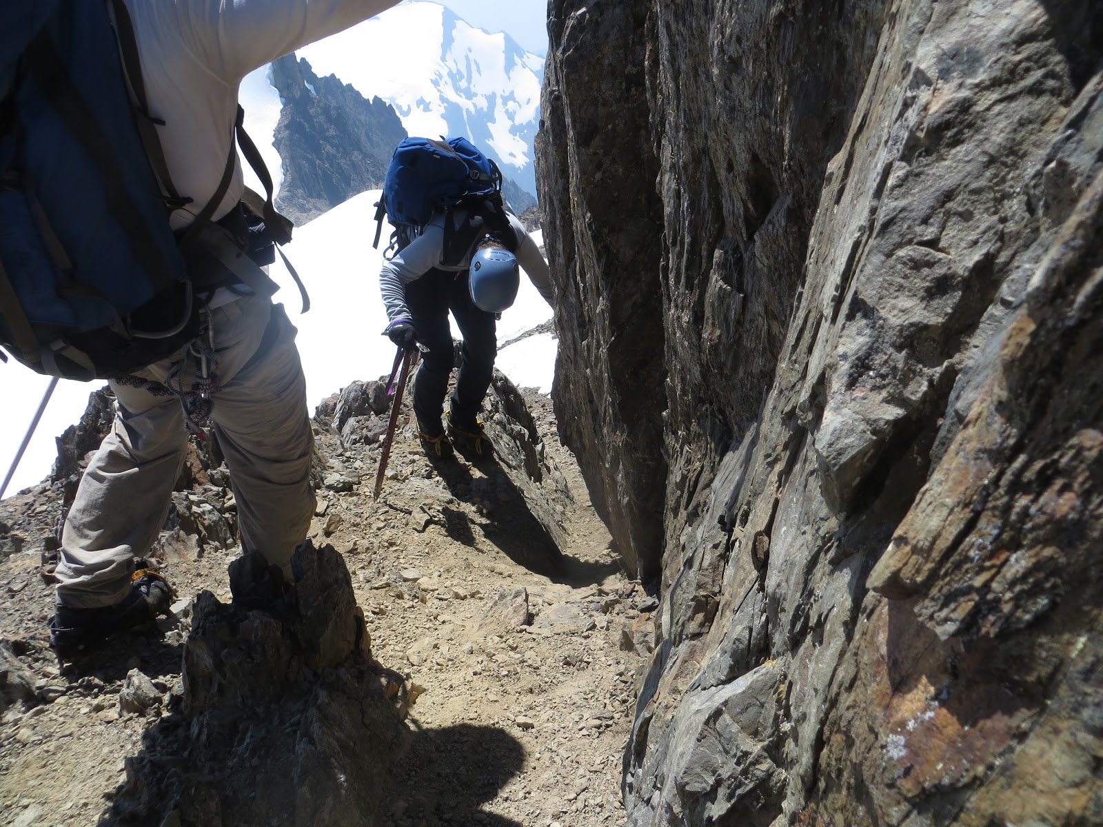
We finally had our turn for to tackle the summit. The three of us scrambled up the loose class three section to some stable rock and roped up. Brian offered to let me lead the short pitch to the top, but after thinking about it, I demurred to him. He made quick work of the short route, only placing one piece of pro. Once Brian put me on belay, I climbed up to join him, trailing a rope for Michael. Soon Michael was at the belay station with us. All we had was a short scramble to the small summit block.
 |
| Looking back on our path from just below the summit |
 |
| Brian belaying up Michael |
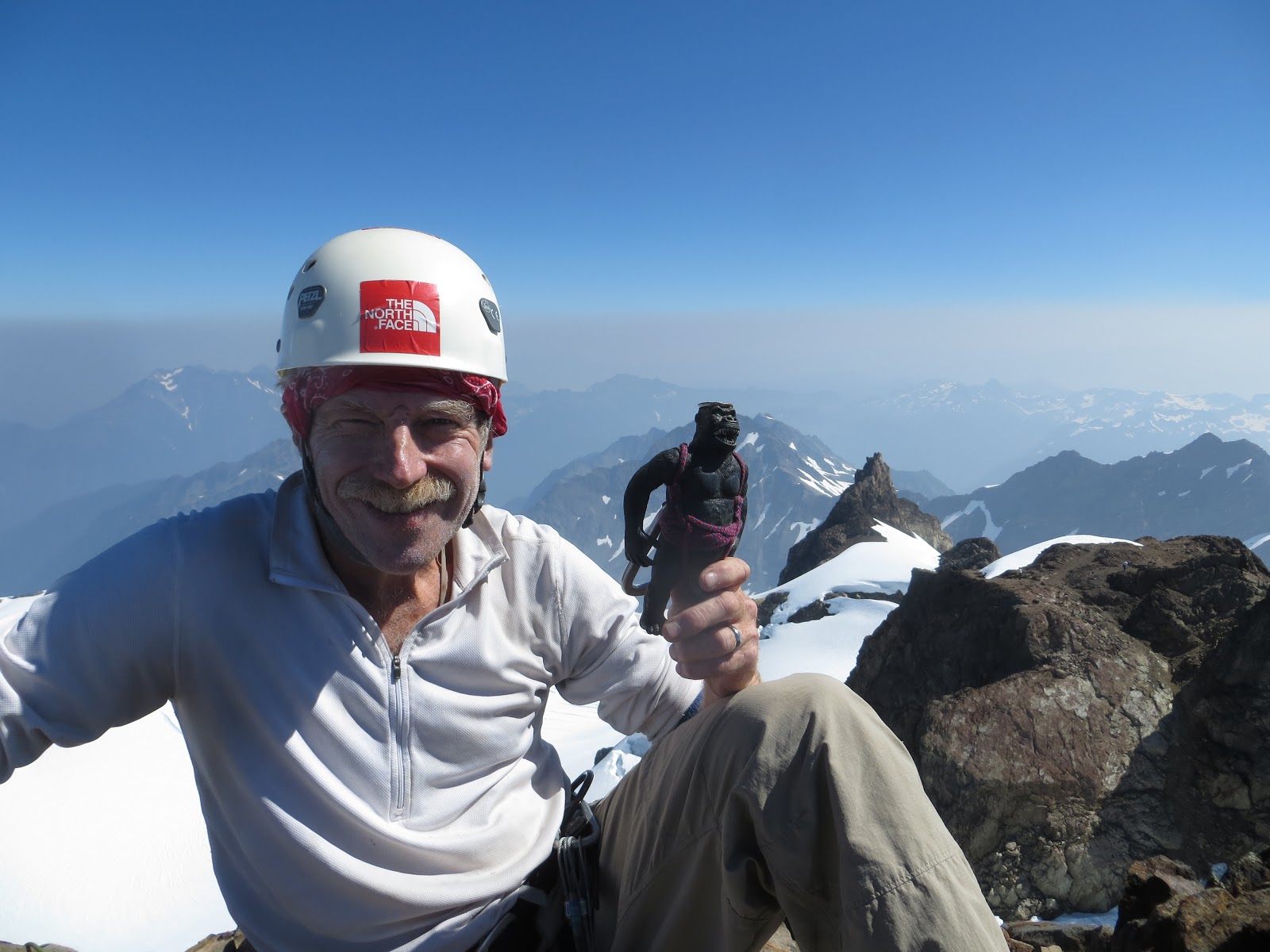
On top at 7969 feet! I know I have never worked harder for a peak under 8000 feet, and I imagine Brian and Michael would feel the same.
 |
| Summit shot! |
 |
| Brian and Jeff! |
 |
| Hero shot courtesy of Brian |
 |
| Looking back across the Blue Glacier and lateral moraine from the summit |
After a few summit shots, we rapped down, collected our gear and started retracing our steps back over the false summit. We were all getting a little hot by this point in the day and were running low on water. The occasional breeze helped to cool us off from the sun baked glacier as we roped up and started across. We followed our disappearing footprints in the snow across Crystal Pass, around the glacier and down the Snow Dome.
 |
| Heading down |
 |
| What you can't see here are the crampons on Michael's feet |
For some reason, we stayed to climbers left after the Snow Dome and down climbed a rocky section rather than stay on the snow. It took a bit of route finding and some nifty rock crampon work, but we eventually reached the Blue Glacier safely.
Once again we roped up to cross the glacier. We were all a bit parched at this point, so we stopped a few times to refresh our water supply with a little glacier water. Unlike the morning glacier crossing, there was almost a continuous stream flowing on the glacier. Almost like walking on water. With me leading, we meandered across the Blue Glacier, eventually getting back to the dreaded lateral moraine.
Rather than risk sliding down the loose rocks on the moraine, we kept our crampons strapped to our boots and did a bit of “technical dirt climbing” to make quick work of the moraine. The hard part was now over.
 |
| "Technical Dirt Clmbing" up the lateral moraine |
We made the short hike back down to camp, broke camp, loaded up our packs and started down the trail to Elk Lake. We had a little traffic jam on the ladder, but Brian used a bit of his east coast charm and we weaseled our way to the front of the line.
 |
| Michael in front of the traffic jam on the ladder |
Soon we were at Elk Lake, our camp for the last night. To celebrate our summit, we enjoyed a great dinner that Mr. Platt had planned along with some Malbec and a small bottle of rye (courtesy of our neighbors). For some reason, there were even fewer flies bothering us, making the evening a little more enjoyable.
 |
| The shelter at Elk Lake campground |
The next morning we started the long 15 mile slog back to the trailhead. Luckily, we encountered quite a few folks hiking up the trail, allowing us to stop and chat. With six miles to go, we rounded a corner and there was Mr. Platt coming up the trail. Having John hike down with us put a little spring in our step, and it wasn’t too much longer until we pulled into the crowded Hoh RIver trail head. Journey complete!
 |
| Brian doing what he loves to do - pump water! |
Stats:
Distance: ~45 miles
Elevation: ~8700 gain
Time: ~ 4 days


No comments:
Post a Comment