Fadgen's Adventures

Fadgen's Adventures
Green Creek Lake

Sunday, July 30, 2023

Coxcomb Peak - 13,663'


Coxcomb Peak, at 13,663 feet, is the highest peak in the Cimarron Range, a sub range of Colorado's San Juan Mountains.  It is very prominent when viewed from most places in Montrose and is one of only a handful of technical 13,000 foot peaks in Colorado.  It's been on my mental peak list since I first saw it.

The day's weather forecast was for 90% chance of showers around 9AM with thundershowers starting at noon.  Finally, the start of the 2023 monsoon season! With this in mind Dylan, Nicole and I were walking up the West Fork of the Cimarron River trail at 7AM.  OK, we should have been there much earlier, but who believes the weatherman anyway?

On the drive in, just before the trail head, we saw a couple of bull moose.  It was going to be a good day!

The West Fork trail is pretty buff and we made great time for the first mile or so, until we took a left and started ascending the ravine between Redcliff and Coxcomb Peaks.
Coxcomb is the flat peak second from left

A forest of flowers, or as Nicole says "a flower forest."

The wildflowers were abundant and it was impossible to not step on them as we traversed cross country up towards the saddle between Coxcomb and Redcliff.
Coxcomb to the right of Dylan and Nicole
The normal route for Coxcomb stays on the West Fork trail, goes over Wetterhorn Pass (12,500') and traverses the southern side of Coxcomb Peak.  Eventually you reach a gully, rope up and climb the gully, and then traverse the summit ridge until you reach a notch.  Here you rappel down the notch, before scrambling back up to the summit.  Seemed like a lot extra of time and effort, especially if it was supposed to be raining by 9AM.

We had found some online references to climbing the north side that looked promising; less mileage, no traverse, and no notch equated to less time.  A little more of an unknown adventure, but it fit our style.
Nicole topping out on the saddle at roughly 13,100'

Dylan and I heading toward the north side of Coxcomb. (N. Kreiser photo)
After the saddle, we had a relatively short, but extremely shitty, climb through loose rock to the base of the cliff.  Here, we donned helmets and harnesses and Dylan racked up to lead.  It was now 9:30 and the skies we're still pretty clear.  Looking good!
Dylan preparing to go

And away he goes! (N. Kreiser photo)
Like the shitty rock below the cliff, the rock on this wall was also loose.  Dylan tested every hand hold to make sure it wasn't going to pull off the wall before committing.  It was a good thing we'd set up our belay off to the side, as several rocks came careening down while Dylan was out of sight.  After (what seemed like) 15 minutes or so, and with 10 feet of rope left, Dylan set up an anchor at the summit and called off belay.

Now it was Nicole's turn.
Nicole starting up
It didn't take long before Nicole finished up and Dylan signaled it was my turn to climb up.  The initial 10-15 feet of rock was pretty good compared to the following 10 feet.  In this section, every rock I touched seemed to be loose, but somehow I made it through without pulling anything off.  Once above this section, the angle eased and it became more of a class 4 scramble to the summit.
Looking up as the angle eased.  Cool notch we climbed through.

Me finishing the scramble with Dylan belaying (N. Kreiser photo)
Once on top, we unclipped and soaked in the views.  And they did not disappoint!
N. Kreiser photo

Summit Splattski
It was now time to head down.  Just below us, previous climbers had slung a huge (stable) boulder to set up a rappel station.  We descended to this boulder and took turns rappelling the 200 feet down to our packs.  The rappel was awesome, pretty much vertical and no loose rock!
Nicole starting her rappel.

And Nicole almost down (D. Fadgen photo).
We finished our rappels about 11:00 as the clouds were just starting to move in.  We even heard a little bit of rumbling.  Hmmm, maybe time to get down?
One last look at Coxcomb Peak.

Heading on down the West Fork trail.

And that's what we did.  We were back to the trail head in about an hour and though it threatened, we did not get rained on.

Another beautiful day in the San Juans!


Monday, August 8, 2022

Wham Ridge - Vestal Peak 13,867 feet

Wham Ridge as we were leaving Monday morning

When we first visited Montrose and hiked in the San Juan mountains last September, Dylan pointed to Vestal Peak in the distance and told me we needed to climb it via the Wham Ridge route.  I did a little research, saw the online photos and was instantly intrigued.  Easy 5th class climbing on solid rock in an alpine setting. Right up my alley!

After a quick 1.5 hour drive to Molas Pass, Dylan, Nicole and I were cheerfully hiking down the trail at 10:30. Yes, we were hiking down.  The initial ~4 miles drops from the parking area at 10,600' down to the Animas River at about 8900'.  Since we were on the Colorado trail, the grade was easy, lulling us into complacency.

My view of the two of them for most of the hike 

Heading down 

The Animas River

We reached the Animas River after a bit and took our first break.  The Durango and Silverton Narrow Gauge Railway travels alongside the river as a tourist attraction.  We had an option to utilize the train to lessen the distance and elevation gain, but their schedule wouldn't work for us on this short over-night trip.

After following the river for a short distance, the Colorado trail takes a left and follows Elk Creek.
Heading up Elk Creek

There were ample opportunities to forage along the trail.  Raspberries, Whortleberries and even Strawberries were all within easy reach.  We did our best to consume as many as possible.
Raspberries

Nicole caught snacking on said Raspberries.

As we worked our way up the trail along Elk Creek, the clouds that had been building started spitting rain.  This was more of a welcome than an annoyance since we were gradually regaining the altitude we had lost.


Our first view of Vestal, the peak on the left way back there.

At the 8 mile mark, we sadly left the well groomed Colorado Trail and started up the climber's "trail" above Vestal Creek.  This trail brought back some fun memories while hiking with a friend around McCall.  Steep, rocky trail, with ample deadfall and the occasional bushwhack through alder thickets.  Normally this is just routine misery, but with the added weight of a full backpack, it was quickly becoming a sufferfest.
The start of the climber's trail

This trial, which brought us from 10,000' to 11,400', was painful for me.  I'm sure Dylan and Nicole were also loving it, but I couldn't tell as they stayed in front of me.  There are a few beaver ponds at this 11,400' meadow where many people choose to camp while climbing Vestal or the adjacent Arrow Peak. 

Our plan was to continue to Vestal Lake, only an additional 3/4 of a mile and 800' of gain, so we marched onward.

Vestal - oh so close, but still so far. 
We hiked to the right of the wet rock before veering left.

Thankfully this portion of the trail didn't have any dead fall. Instead, it switch-backed it's way almost vertically before terminating in a talus field.  A little boulder hopping through the talus and we were soon exhaustedly setting up our tents near Vestal Lake.
The talus field
Vestal Lake is just up over that green ramp above Dylan's head

Camp

Reflection of West Trinity Peak on Vestal Lake (D. Fadgen photo)

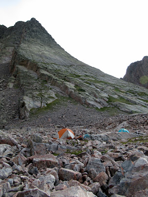
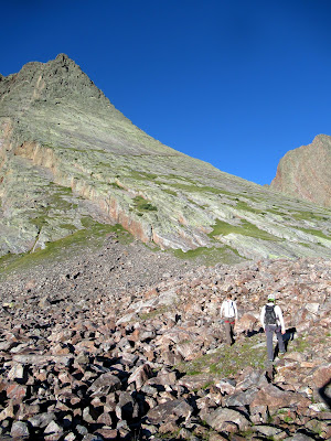
We woke up to a beautiful morning and were excited for the climb.  After some breakfast and a few minutes throwing rocks at a marmot trying to invade our camp, we started up the rocky ramp to towards Wham Ridge.
Wham Ridge is along the skyline.
We followed the highest thin green line that looks horizontal to get to the climb

A short 20 minutes later and we were staring at our route while racking gear.  It looked like it was going to be a good day! 
Gearing up

The plan was to simul-climb.  Dylan would lead and place gear where appropriate.  Nicole would then follow, with me another 4 meters behind her cleaning the gear.  When Dylan would run out of gear or find a nice ledge, he'd stop and belay us up.  With this being a 5.4 YDS route, setting a belay at the end of each rope length didn't make sense and would take a lot of time.
Dylan starting off

And Nicole following

Not too steep

Nicole cruising

All smiles at the first belay

The climbing was relatively easy - moderate pitch, quality rock, and there was always a foot or hand hold when you needed one.  Top that with beautiful weather and being with my son and his partner and you have the mix for a great day.

John Platt took me on my first alpine climb, 2011 Slick Rock

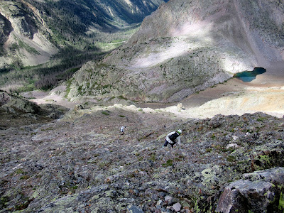
Looking back down to camp

We popped over the top of Wham Ridge a couple of hours after we'd left camp.  After stashing the rope in the pack, we dropped down a short notch and walked up to the summit.

John at the top (D. Fadgen photo)

Summit Splattski

The views from the top were spectacular.  There were mountains 360 degrees around us, and we took it all in for a few minutes.  But not too long, as we had to drop down the back side, slide down a scree slope, and boulder hop our way back to camp.  After a re-pack of camp, we then had an 11 mile hike back to the car.  We still had a long day ahead of us.

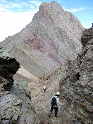
The maze that was the descent route

Still more down

I'd like to say that the walk out was pleasant, and for the most part it was OK.  We had hoped for cloud cover like the previous day, but the clouds didn't cooperate much.  
So it was warm.

We retraced our steps down the steep face to the beaver ponds and then wound our way through the alder and deadfall back to Elk Creek and the well maintained Colorado trail.

A look back at what we'd just done

Heading down Elk Creek

We were all a bit tired as we arrived at the bridge over the Animas River a couple of hours later.  Remember the ~4 miles of downhill when had on the way in the previous day?  Now it was uphill.  1700' of uphill on tired legs. We were all wishing we'd taken the train!

One last look back while resting during the 1800' pull back to the car

The uphill pull was tough, but it didn't break us and we eventually made it to Ouray in time for burgers and beers at the Ouray Brewery.  

An excellent alpine adventure!

Stats - 
Distance: ~24 miles
Elevation: ~7500 between both days
Time: Who cares!


Thursday, September 24, 2020

North Face of Cobb Peak (11,650 feet)

Dylan and I first saw the North face of Cobb Peak from our climb of Hyndman Peak, a few years back.  At that time we could only dream about climbing it.  

On top of Hyndman in 2010 with Cobb behind us

Fast forward 10 years, and we were going for it!  

Dylan and I had done a couple of Pioneer alpine climbs the previous two years, and I threw out the idea of the NF of Cobb without having any idea if it was even feasible.  Dylan, being Dylan, accepted the idea without hesitation.  The only beta I could find was from Sun Valley Trekking, and it mentioned solid rock with a couple of 5.8 moves. Seemed to be in my wheelhouse...

After a lazy Saturday evening kicking around Ketchum, we woke up to clear (no smoke!) and cold conditions at the Hyndman Creek trail head.  A quick cup of coffee and we were off a little after 7AM.

A cold start!

Cobb Peak (South Face)

In an effort to stay warm, Dylan set a fast pace and we made good time on the 3 miles of flat trail.  The steep pull up to the 8700' basin was followed by another incline into the upper basin at 9400'.  As we headed toward some sunshine in this upper basin, we ran into John and Alyson Kirk of Lists of John fame.  After a quick hello/goodbye we stopped in the sunshine to warm up, eat something, rack gear and look at our objective.

Upper Hyndman Basin

Which way should we go?

Once ready, we headed back down into the shade, crossed the creek, and carefully climbed up the scree field to the base of the wall. I had printed out a picture of the SV Guide's route for reference, but we opted to pick our own line.

Once ready, Dylan took off up the wall as I belayed him and shivered in the shade.  When it was my turn to follow, I was surprised at the difficulty of the first few moves up the steep wall.  Maybe it was the cold (I could barely feel my fingers) or the butterflies, but the first few moves felt like 5.8 right off the bat.  I was hoping things would get easier and said as much as I met Dylan at the anchor.

Close to the end of pitch 1 (D. Fadgen photo)

Contemplating a big move! (D. Fadgen photo)

In his element

Looking up at pitch 3 or 4

Close up

Dylan figuring out his line

The going did get a little easier in the steep, high quality Quartzite.  There was also a considerable amount of moss thrown in with occasional snow on the ledges.  All great fun! 

As we got higher, the temperature stayed about the same, but at least we had feeling in our fingers again.  Though cold, the climbing was very enjoyable with solid holds available for the committing moves.
Hard to keep a smile off his face

Top of pitch 6? getting ready to break out into the sun

Ahhh!

We had one last pitch along a knife edge ridge before we reached our exit close to the walk up route.  We'd climbed over 1000 feet and it was now 2:30.  Where had the time gone? 


Since we were only 600-700 feet from the summit, we figured we'd make quick work of getting to the top.  In hindsight, it might have been easier to stay roped up on the knife ridge. The trip to the top was a mixture of loose rock and steep slabs.  It would have definitely been more fun on a different day.


We eventually made it to the summit at 11,650 feet, but didn't linger since it was still a bit chilly and it was getting late. 
All smiles on top!

We carefully picked our way down through the steep, loose rock and then continued down, and down, and down until we found the main trail.  We did our best to move fast on the trail and eventually reached our rigs just as the sun set.


This was truly another great alpine climb with my son.  Limited beta, mixed with route finding and some committing moves several hundred feet above the deck.  What a way to live!

Our route


Google Earth Track

Blog Archive

Followers