Fadgen's Adventures

Fadgen's Adventures
Green Creek Lake

Wednesday, April 22, 2020

Danskin Moto Dodge

Saturday April 18

Dave had a springtime plan - 4 peaks, 4500 feet of gain, 16 miles and close to Boise.  Who was in?

In keeping with the times, Dave, Michael and myself met up outside of Boise and caravanned in separate vehicles into the Danskin Mountains.  Along the way we passed several motorized recreationalists enjoying the early morning sunshine around their campfires.  Motorized vehicle access had opened in the Danskins the weekend before and we figured we might miss some of the traffic if we got an early start.

It was a beautiful, sunny morning as we quickly made our way up an ATV trail toward our first peak of the day - Devil's Hole Peak.  We made good time considering we stopped on several occasions to identify the various birds in the area.

Little Fiddler from the saddle

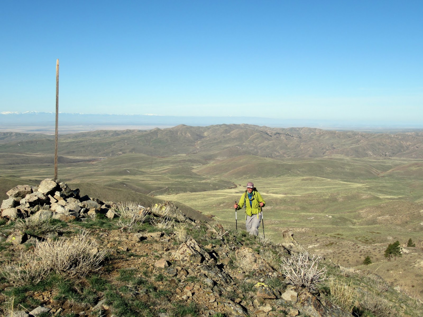
The ATV trail meandered up a draw until it reached a saddle and then dropped toward the South Fork.  At the saddle we took a right and headed up a steep, faint trail to the summit of Devil's Hole Peak at 5944 feet.
Dave photographing Devil's Hole Peak

South Fork of the Boise Canyon

Michael approaching the summit of Devil's Hole
Knowing that we had a long day ahead of us, and the fact that Dave is slightly crazy, Michael and I opted to not traverse to the second peak, but rather meet Dave on our way to Little Fiddler.  Dave bid us goodbye and took off down the north ridge towards Peak 5081.

With some time to kill, Michael and I took our time walking back to the ATV trail before heading north on a motorcycle trail toward Little Fiddler.  We stopped at every opportunity to identify more birds.

Dusky Grouse

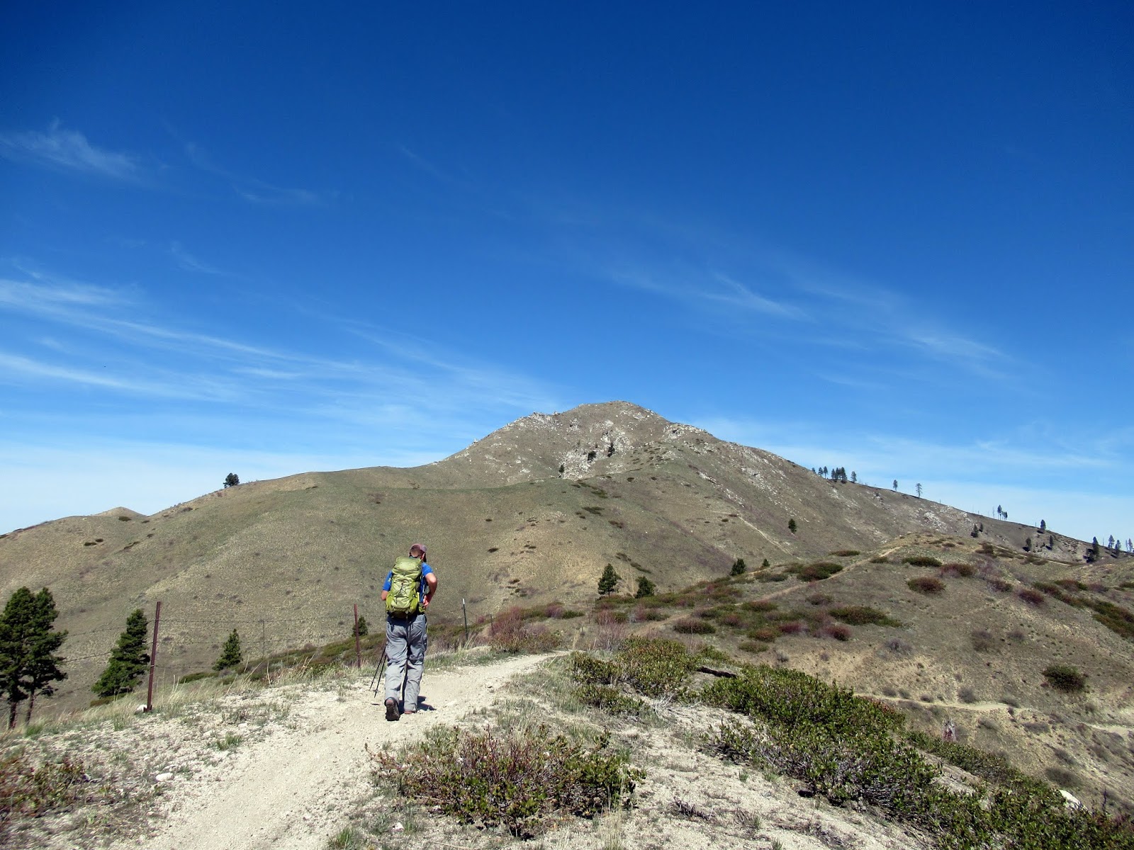
Michael on the moto trail heading toward Little Fiddler
After a bit, we picked a nice spot in the sunshine and lounged around talking while waiting for Dave to join us.  Once Dave came hustling along, we proceeded to follow the nice sandy trail to the base of the third (or second) peak.  We were feeling good with the fact that we had only heard a few motorcycles and hadn't crossed paths with any at that point.

After a short, steep grunt we were on top of Little Fiddler at 5849 feet.  We were about as far away from our vehicles as were were going to get, and my out of shape feet were barking at me.  Oh well.

Dave and Michael social distancing on the summit
After a relaxing lunch on top, we backtracked a bit and then started down a different motorcycle trail.  By this time we could hear people buzzing all around us and occasionally see groups below us.
Mountain Bluebird
As we dropped lower, we eventually ran into a group of motorcyclists coming down the trail.  After moving off the trail and having a few words (Nothing bad - both Dave and I knew one of the guys from previous jobs) we continued down.  It was difficult to pick out the next objective in all the folds of the Danskin Mountains, but List of John said it was there.
Our main objective for the day - Peak 4786
We dropped down to meet up with another ATV trail at the base of rounded Peak 4786.  Since we were at the base, both Michael and I decided to give in a go.  I figured we could reach the top in 15 minutes.  It took 10.
Little Fiddler from the top of Peak 4786
After that tough summit it was just a nice spring walk along an ATV trail back to our rigs.  For the next four miles we side stepped to let UTVs, ATVs and motorcycles pass us.  All in good fun.  

We made it back to the rigs tired but happy!

Map - 13.4 miles, 3700 feet gain for Michael and I

Sunday, September 29, 2019

The Not So Dawn Arete

September 15, 2019.

Howard at sunrise
(Written by Dylan)
I departed Logan around 9pm, full from a big dinner and with a solid handful of dark hours to drive to meet Dad at the Garden Creek CG. We recalled staying here during the Rosencrance IdahoSummits Outing in 2013 and it seemed like an ideal place to meet for a trip up Wildhorse.

I only nearly hit one herd of elk on the drive up before rolling in around 1AM, stirring Dad. We talked briefly about start times in the morning, and settled on 7AM. I slept hard until the alarm and my bladder rousted me precisely at 7.

We didn't have a clear plan of where we wanted to go, but with the goal of a few pitches of roped climbing and maybe a summit of Howard peak guiding us, we figured to try to find the Dawn Arete. I had been up Mustang the week earlier, and I had a reasonably good idea of how to get there (or thought I did.) We decided to take the trail to the approach scree on the West face, and skirt around to the east above the trees but below the cliffs. This sort of worked, although we ended up dropping into the east fork of Wildhorse anyway. Sure, we had worked way harder than we needed to, but at least we were only behind schedule, right?

Now where is it?
Now in the drainage, the understanding that we really had no idea where we were going sunk in. Is this arete the Dawn? This one? That one? Should we go try to climb something on Howard? What if we try to climb what looks like could possibly be the Dawn but would still look fun? Let's do that.  We settled on a short, steeper arete that emptied into the steep headwall surrounding the rim of Mustang's East face. 

Picking a route, we went directly up the waterfall in the notch

Howard's East face (L), Mustang's East face (R)

Heading up. We climbed the right skyline (about)

Rockfall across the valley on Brocky
We found a slot/waterfall through the lower cliff bands at the base of the East face of Howard. A little  zigging and zagging brought us to our route. Gaining the arete looked a little steeper and smoother than we wanted to do unroped, so we broke out the cord and got going. A quick pitch of face with some interesting dihedral moves brought us to the arete proper. Fun climbing ahead!

A little roped climbing to gain the arete. I try to make my anchors look nice for the camera. And my mom. 

P2, the Offwidth on the arete
From here it was pretty obvious we were not of the Dawn Arete. Who cares, this looks sweet! Maybe we would care later.

The actual Dawn Arete
The climbing on the arete was some of the most fun and rewarding backpack-on alpine climbing I've done. Most notably, a fun 20' off width section that brought you to a small gendarme traverse, up to the goods. The Split Pillar. A glass smooth pillar about 18" wide and 30' long, entirely detached from the rest of the arete, but stuck in place with a good dose of Pioneer Magic. This was capped off by a fun roof to absolutely bomber hands.

P2, the Split Pillar

Looking back on the Split Pillar
After a lot of excited yelling and some light swearing, I pulled through the pillar and the roof to the absolute garbage above. Out of rope and nearly out of gear, I popped in an anchor at the lip of a nice ledge and brought Dad up. He took the next ledgy pitch, and belayed at the base of the headwall.

John following P2

P3, Pa's Pitch

Following P3
Here is where things got interesting. The rock is worse; mostly sand held together with lichen. With more lichen on top. All of the ledges are covered with gravel. There's an occasional tree. I decided to quest up the center of the face, hoping to piece together something fun and a little challenging, with the knowledge that we could always bail left if things got too "engaging." Things got too engaging. I groveled onto a ledge with a few small lodgepoles on them, hoping to cut left and get out of here. But, I was out of rope. I belayed Dad up and we settled in for the next part of the show, what he later dubbed "The Tightrope."

Some ledge action


Starting the Tightrope pitch (P5)

Mid-pitch

Looking back from the rim- Zoom in for some slung-horn action!
I gently moved out left to the end of the ledge, and started tiptoeing across small edges to the end of the face. My pack seemed to pull me out over the headwall, taunting me with nasty images of ledge falls and broken rock. I tested every piece of rock I touched, waiting for something to break in my hands. No holds broke on this pitch, but if they had it wouldn't have been pretty. I climbed a good 40' off of the ledge, and finally found some rock good enough for some pro. I slammed in a yellow totem and immediately slung a solid horn after, feeling miles better. The rest of the pitch flew by. I pulled onto the ridge and into the sun, quickly wrapped the rope around some boulders, and brought Dad up.  An exciting pitch!
Excited!
Finally done, we considered the potential for this to be a new route. Was anyone misdirected enough to climb this house-of-cards chosspile? We should find out.

We left Howard for another day and headed down without incident.

Trail Creek East
We motored down the road and out to Amy Lou's, with plenty of time to spare for burgers before another long night drive.

Monday, September 9, 2019

Broken Arrow Arete, Mustang Peak

August 31, 2019

A quick climb in Wildhorse.

Nicole and I left Logan around 5PM, and after a rather large Wendy's order we were headed north to the Pioneer Mountains in Central Idaho. We were hoping to score a spot in Wildhorse Campground, and either drive or pedal up to the Wildhorse TH in the morning. It was Labor Day weekend, and as we neared the campground it became apparent finding a site would be iffy at best. However, we got lucky and pulled right into a nice site, and turned off the lights around 1am. 

Around 8 the next morning we rolled out of camp to the notoriously rough road to the TH, and decided to go for it in the car. After about 45 minutes of careful driving and a few moose sightings, we were at the trailhead. 

We went up the leftmost "scoop" to the skyline. 
The route is relatively straightforward: Go up the trail until you come across a large talus slope that looks like it will get you where you want to go, then scramble up until you feel like pulling out the rope. We decided to head up the face to a small col, then rope up there. 

The scramble

Rope time!
At about 11:30 I took off from our ledge just below the ridge. It looked like there was about 3 pitches of climbing to the top of the arete. The arete is a beautiful, exposed piece of rock, typical to the Pioneers. Long featured blocks of quartzite took protection readily, and there always seemed to be holds where you needed them. 

Looking up

Looking back on P2
Somewhere in the middle of the steepest section of the ridge (P2? My memory fails me) a stunning right facing dihedral opens up. It is almost vertical, and looks about featureless. As I got closer to this dihedral, it looked more and more difficult, maybe more than I wanted, given that my last piece was some 30 feet below me. As I made the decision to enter it, however, I noticed a beautiful 1" crack splitting the whole left side. Sweet! Fingerlocks and gear and good feet made that forty or fifty feet the highlight of the technical climbing. 

Topping out P3
After the dihedral pitch was another full length blocky ridge pitch, and then the final fifty or so feet of roped scrambling to the end of the arete, bringing the pitch count to 4. Time to stow the gear and head to the summit for the day!

Wildhorse Canyon below 
Almost to the top
We topped out, sunned ourselves for the better part of an hour, and began the talus walk back to the head of Wildhorse creek, and then back to the awaiting cold Wendy's cheeseburger from the night before. One of the best burgers I've ever had! It turned out to be a long day, despite only being about 6 miles and 3,000' of gain. 


Sunday, September 8, 2019

Lem and Tendoy Peaks

Link to previous day

Monday, August 12th

After a good night's sleep along the Salmon River and a great breakfast at a Salmon gas station cafe, we were on our way to our next objective - the peaks surrounding Bear Valley Lakes basin in the Lemhi Mountains.  With loaded backpacks, we hit the trail a little after 9AM.

Ready to go
The trail up to the basin had recently been cleared and didn't offer any outstanding views as evidenced by my lack of photographs.  We covered the roughly 5.5 mile trail in a couple of hours and set up camp near the largest of the Bear Valley Basin lakes - Lake 9135.

Our view for the night
After pitching our tents and a quick bite, we were off to our first objective - Tendoy Peak.  Tendoy was very prominent above our lake, but the summit wasn't obvious from below.  We opted to head straight up the steep NE ridge.  After a bit of huffing and puffing, were strolling along the broad ridge leading to the final steep rocky ridge to the summit.  A little bit of scrambling later and we were on the summit at 10,720 feet.
Tendoy Peak
Lake 9135 and Lem Peak from the ridge to Tendoy
Dave's summit register dance!
We took a short break before we split up.  Michael and I opted to head back, while Dave decided to follow the ridge to Peak 10,225.  I made it back to camp in time to wash off the 3 days of accumulated grime while in the sunshine.  Dave eventually showed up just before dark with a big smile on his face!  Mission accomplished!

Day 3 stats 
Distance - 8.5 miles
Elevation - 4400 feet
Time - 6 hours


Tuesday, August 13th

We had another alpine start the next morning as we hit the trail a little after 8AM.  After following the un-maintained Allison Creek trail south from Lake 9135,and crossing multiple wild flower filled meadows along the way, we broke out onto a broad plateau below Lem Peak.  This is some beautiful country!

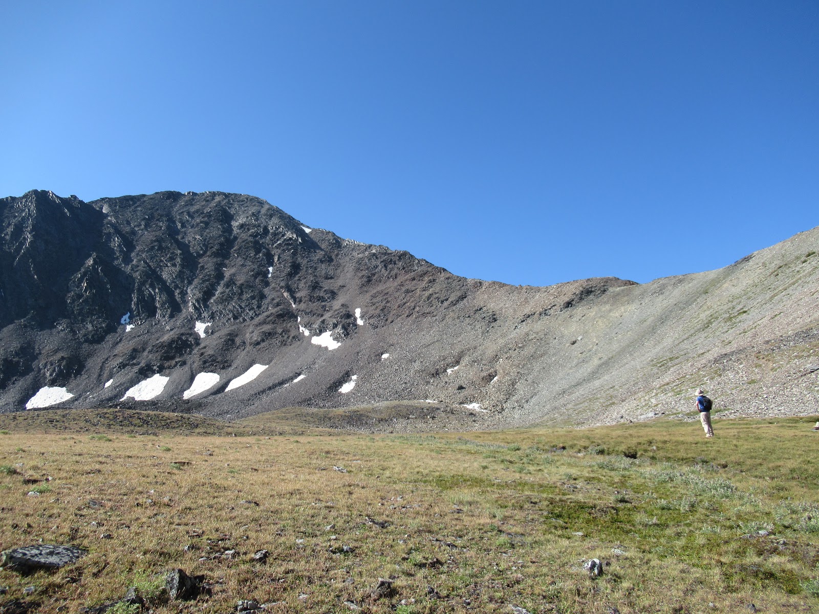
Lem Peak
Dave looking for the best route to the top
The remnants of the trail switched back and forth across the scree before heading up to a saddle, where it joined an old Jeep trail coming up from the other side. The Jeep trail looked like it'd be a nice gentle route.
Saddle below Lem Peak
We took a short break at the saddle to hydrate and re-fuel.  From the saddle, we did our best to follow any bit of goat trail we could find.  For the most part we did a great job, with the exception being a short portion I led.


I followed what I thought was a goat trail only to have it wither away.  Faced with either back tracking to the ridge or heading up the steep, loose rocks, I chose the latter.  After a short, 50 foot stretch of very loose rock, we were back on the ridge.  Whew!
Michael navigating the loose section
After bypassing a few gendarmes and skirting another sketchy section or two, we were on the summit at 10,985 feet!


Sort of summit Splattski
The surrounding views were a bit hazy, but still outstanding!  After a short break, we re-traced our route down.  After all, Dave had another peak to climb!
Heading down
While Michael and I lounged in the sunshine in a large meadow below, Dave continued on the connecting ridge to Peak 10,456 (Little Lem Peak).
Dave on the summit of Peak 10,456

Close up
Dave eventually re-joined us and we strolled back to our packs and then proceeded down the trail back to our vehicles.  Other than meeting a group of disgruntled youth, with oversized packs, headed up the trail, the trip down was just long, dusty and hot.


Once back to the cars, we bid goodbye to Dave, and Michael and I turned north to our next objective - Snowshoe Peak north of Missoula, Montana.

Just south of Salmon is a place called the Baker Country Market. This is an Amish run place with a large assortment of canned and baked goods, including an excellent deli.  The sandwiches, which featured fresh bread, vegetables and possible homemade mayonnaise, were to die for!  Of course, a full day of hiking could have had something to do with that...


Day 4 stats 
Distance - 10.4 miles
Elevation - 2200 feet
Time - 7:15


Blog Archive

Followers