Dylan and his buddy, Thomas, set up a trip to Mexico to climb North America's third tallest peak back in August. Once I caught wind off it, I weaseled my way into being a part of it. After all, Pico de Orizaba is the third tallest peak in NA, after Denali and Mt. Logan. With the climbing being based out of Puebla, I talked my lovely bride into coming down with us. It was a win-win situation - I could climb with the boys and she could visit with her sister (and her family), who just happened to live outside of Puebla City, in Cholula.
Tamara and I arrived in Puebla City Sunday evening after Dylan and Thomas had achieved a personal altitude record while climbing
La Malinche that morning. The next day we toured the downtown Cholula area, ate some Tacos Arabes, and got settled in with the Rodriguez family.
 |
| Tamara and I with Popocatépetl on the left and Iztaccíhuatl on the right |
The boys had Tuesday pegged as the day to travel to the trail head for our attempt at Iztaccihuatl or "Izta" at 17,160 feet. You can read about "Izta" here:
https://en.wikipedia.org/wiki/Iztaccihuatl As "Izta" is considered the sleeping lady, the trail traverses from the feet, to the knees, across the belly, to the highpoint, the chest (pecho).
I kissed the wife goodbye just as the Uber driver pulled up. The plan was to Uber to San Nicolas de Los Ranchos and then find a taxi to take us to the Izta-Popo Zoquiapan National Park headquarters on Paso de Cortes. Turns out this is the "non-standard" route, due to the 20km of dirt road required to get to the park headquarters.
But Dylan and Thomas worked their magic and convinced the Uber driver to take us all the way to the park headquarters "por dinero".
We knew we needed to purchase passes at the park headquarters to climb Izta, so we did that. Then, we went back outside to find a way to get to the La Joya trail head, 8km up another dirt road. After 20 minutes or so, I flagged down a taxi driver heading over the pass who offered to take us to the trail head for a small fee.
 |
| "Popo" from the park headquarters |
 |
| The south side of "Izta" from the park headquarters. The "feet" are on the right. |
 |
| La Joya trail head |
We'd brought camping gear with the intent on staying at La Joya, but the wind and cold had us considering staying at the refugio. I convinced the guys that we should at least walk up the mile to check out Refugio de Altzomoni.
 |
| Heading to the refugio |
It was a good call. Though, apparently, you are supposed to pay to stay at the refuge, we convinced a nice Mexican gentlemen to allow us to share his room. After all, we didn't have transportation to get to the park headquarters. He was there to cook for a guided group acclimatizing for Pico (
Climbing the Seven Summits) and offered up some bunks in his room for a small tip.
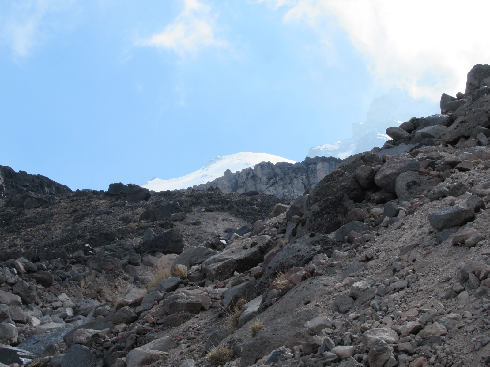
Our original plan was to get going at 1AM, but we changed that to a 3AM start. When we left, the weather was clear and not too cold, considering we were at 13,000 at 3AM. We retraced our steps to the La Joya trail head, stashed our duffel bag, and started up the steep trail. The trail to the summit of "Izta" follows the curves of the body of the "Sleeping Lady" to her chest.
As it was dark, and the trail was steep, I did not take any photos. After a couple of hours, we arrived at the refugio at the base of the "knees" at 15,450 feet just as it was getting light enough to see without a headlamp. It was occupied by the group that had left our refugio earlier, so we didn't linger.
At this point, the trail really steepened and we had to deal with loose volcanic soil and rocks as we ascended the "knees". After struggling for half an hour in the loose, steep crap, we eventually reached a ridge just at sunrise. And to our amazement, Popo let off a cloud of smoke!
 |
| Dylan on the ridge with Popo behind him |
With sunlight came strength. We had a short, fun, class 3 scramble to the top of the "knees" and could finally see our summit. Or could we?
At this point it was close to 7:30, we were above 16K feet and the summit looked a long way off.
 |
| Summit is back there somewhere |
We eventually came to the remnants of the stomach glacier, necessitating crampons for some security.
 |
| Crossing the glacier |
 |
| Looking back across the glacier (note the one crevasse on the left) |
After a couple of undulations, we reached the crater rim. It was 9:45, and I was beat. Dylan pointed out that though this was recognized as the summit (there was even a marker), the true summit was across another snowfield.
So, we set off across the crater snowfield toward the true summit. Maybe is was the altitude (17K feet) but the north summit seemed a long way away. It wasn't.
 |
| I'm the good looking one without the facial hair. |
We reached the summit, 17,160 feet, at 10:15. Hugs all around, a few photos, some snacks, and it was time to turn around. We were the only ones on top, and we could not see any one else following our tracks.
 |
| Heading down |
It was an uneventful descent other than the clouds building on the southern (trail head) side making for a cool hike.
We eventually reached the La Joya trail head at 2PM, for an 11 hour, 10 mile, 5000 foot day. We were all whipped.
Now we needed to figure out how to get back to Cholula. Unfortunately, we didn't think about hiring someone to meet us a the trail head and drive us back. Unlike me, Dylan and Thomas were not worried. So after a short break, we loaded up - Dylan with his and Thomas's packs, Thomas with the camping duffel, and me carrying my gear, and headed down the road.
As we moved slowly down the road, we spotted a box truck heading down from the refugio. Even luckier, they happened to see Dylan running down the trail in their direction and stopped! With the three of us squeezed into the back of this telephone company box truck, a short bumpy ride brought us back to the National Park headquarters.
 |
| Happy that we have a ride down! |
While waiting around outside the park headquarters, a taxi (with customers) stopped. After a couple of gyrations with Google translate, we eventually figured he would take us down our side of the mountain after he transported his current customers down the other side.
He said he'd be back in 40 minutes. Two hours later, he showed up and we hopped into his van for the mad scramble down the dirt road. Rather than take us to Cholula, he dropped us off in the town square of the first little town we came to.
 |
| In the taxi |
Ten stressful minutes later, a van showed up with a Cholula sign in the window. Our ride! We climbed in and spent the next hour and a half crammed into the mini-van "taxi" with all our gear and between 6 and 12 other people. We eventually reached our destination a little after 7PM, exhausted.