Fadgen's Adventures

Fadgen's Adventures
Green Creek Lake

Monday, October 28, 2013

Moolack Mountain (Peak 10,330)

 
Since this was forecasted to be the last warm fall weekend, I wanted to get out and climb something in the Sawtooths before it was time to start skiing.  I texted John to see if there was something in the Sawtooth Mountains on his list, and he promptly responded with 8-10 suggestions.  On top of his list was Peak 10,330, and we set up an early Sunday morning rendezvous in Banks.

After dodging a half dozen rigs full of elk and deer hunters, we were on the trail out of Grandjean, at 8AM, in absolutely gorgeous weather.  Though the forecast was for a big change that afternoon, we were marching down the trail in cool temps, bright sunshine and no wind.

As we moved from the South Fork Trail to the Baron Creek Trail, four summited, Grandjean Peak towered above us. 

At the five mile mark, we headed off trail at Moolack Creek trying to stay out of the brush filled drainage as much as possible.  No such luck.
Moolack Creek
This first section of Moolack Creek was a grunt.  Bushwhacking and steep terrain made for a difficult first 1500 feet, but after a short while, we popped out into an open basin and stopped for a bite to eat.  Here we had views of our peak as well as Baron Peak.  Baron was to be a secondary climb, assuming we had time and the legs for it.
Baron Peak in the center
The summit of Peak 10,330 is the left tower of the two just to the left of center
Tom Lopez's book suggests climbing Peak 10,330 from the Baron/10,330 saddle, but after looking at the mountain, John suggested we just head straight up one of the gullies.  Not being one to disagree, I said we should go for it.  After picking our way through the stunted trees, we reached the chosen gully and started making the steep trudge up.  It was slow going in the loose sand and rocks as we zigzagged back and forth to the base of the rocky summit outcropping.
The rocky summit of Moolack Mountain
By this point the wind had picked up, so we dropped our packs and started climbing the steep, rocky, fun section.
 
Unfortunately, the fun scrambling only lasted 50 feet or so, but nonetheless it was great!  The views from the summit weren't too bad either.
Warbonnet Peak

Baron Peak
A couple of happy guys
Surprisingly, we found Sawtooth Sean's original summit register, and no one else had signed it.  We didn't want to soil it with our signatures, so placed it back.

After snapping some pictures, we took our time coming down the summit on the extremely loose rock.  Once off the rocky section we discussed heading over to Baron, but with it being 1:30 and with clouds starting to form, I didn't think it was wise.  (Actually, my legs were killing me!)  With that decision made, we dropped down a thousand feet and stopped for some lunch and to admire the views again.

From this point we tried our best to stay out of the brush as much as possible as we grunted and groaned our way down the 4000 feet to the main trail.  Once back on the main trail we did our best to move as fast as possible back to the car, but the dogs were barking.  Thankfully, we made it back to the car at 6PM.

Stats:
Distance: a little over 15 miles
Time: 10 hours
Elevation: 5200 feet


Sunday, September 15, 2013

Two Devils and a Baal

 
He Devil from Sheep Lake
John had put out an email a month ago to a half dozen folks asking who was up for a Seven Devils trip for Saturday.  After some texting and other email traffic, three of us were left.  I met up with Dylan's buddy, Dan, at 4AM for the short two hour drive north to McCall where we grabbed John and continued north.

After another two hours, we were at the Heavens Gate campground, and on our feet at 8AM in cool sunny weather.  NOAA had forecasted a 20% chance of thunder showers and with the storms we've been having the past week, we were excited with the conditions.

Our plan was to climb several peaks in the area, He Devil, She Devil, Mt Baal, and possibly Tower of Babel, were all on the list.  Rather than hike on the main Seven Devils loop trail, which is something like 9 miles to get to the center of these peaks, we elected to take the shorter, albeit steeper, Sheep Lake Climbers Trail.  This "trail" is more like a goat path, switchbacking up to a mountain saddle, travelling along a ridge with a couple of precarious areas on the north side of this mountain, and then dropping steeply down to Sheep Lake.

And speaking of goats...  Once starting up the trail, Dan spotted this guy.

We made Sheep Lake in a about an hour.  With He Devil towering in front of us, we skirted the lake on the south side and headed up to a saddle.  After a quick bite to eat, we crossed a large boulder field and gained the northern ridge of He Devil.  From here it was a great scramble up to the summit, which we obtained at 11:00AM.


The skies looked hazy, but with all the rain we have had lately, we figured the area fires were all out and it must just be moisture in the air.  Other than the haze, the views from the summit were spectacular.

Some of the many lakes in the area with Hells Canyon in the background.
The final summit block of He Devil
The next peak on the list was She Devil, just to the west of He devil.  Dan left us at this point, as he'd climbed She Devil years prior and had bad memories of some scree filled gully.

John had climbed She Devil from He Devil a decade ago and knew of a route that dropped off the steep southern side of He Devil.  We wandered around a bit and then descended down 50-100 feet, skirted to climbers left and found a steep, tight gully that lead down.  The loose rock required us to take this gully one at a time to prevent injury.

John dropping off the summit of He Devil
Down climbing the steep gully
Once down the gully John and I split up some.  I explored a route trying to stay high, while John immediately dropped down.  After putzing around a bit, I decided to just head down rather than risk the possibility of ending up on a cliff.  I found a ramp and dropped down through the scree to meet up with John at the saddle between She and He.
 
Once down in the saddle, it was time to head up again.  The route was well marked with cairns, which took some of the fun out of the ascent.  We purposely took a variation that ended up with a bit of class 3+ scaling of the summit block which we obtained at 12:30.
Ramp leading to the summit block
The final summit block to She Devil.
A look back at the route off He Devil (upper right corner).
Apparently She Devil is a few feet shorter than He Devil, though neither have officially been measured.  The altitude of each is approximately 9400 feet.  John and I debated this fact as we had another bite to eat on the summit of She Devil in the sunshine.  We were both feeling pretty good at this point and continued west towards Mt Baal.  The "peak" is in between She Devil and the Tower of Babel and looks great from Sheep Lake.  From our vantage point it didn't look too bad, but not as imposing as it looks from below.
It didn't take too long to obtain Mt Baal, probably 30 minutes after getting off the summit of She Devil.  From here we longingly gazed at the Tower of Babel.
Mt Baal
 
But, with Dan waiting for us at Sheep Lake, and it being a little after 1PM, we decided to head down.  After dropping off Mt Baal, we came to the source of Dan's nightmares - the dreaded gully.  It didn't look too bad, almost looked like we could boot ski all the way down.  But after several hundred feet it became apparent that this wouldn't be the case.  The rocks gradually became larger and the going much more difficult.
The gully

John "boot skiing" down
After 30 minutes and 1000 feet of hell, we joined Dan at the lake where I know he was laughing his head off as he listened to all the rocks falling down in front of us. The gully was tough going down, not sure if I'd like to try going up it.

From here it was just a short jaunt up another 600 feet over the goat trail called, The Sheep Lake Climbers Trail, back to a cold beer waiting for us at the car.  We arrived at the car a little after 3PM with very sore feet.

John's Trip report: http://www.splattski.com/2013/devils/index.html

Stats:
Distance: 6.3 miles
Elevation gain: ~4500 feet
Time: 7.25 hours

Monday, August 12, 2013

Leatherman Peak - 12,230 Feet


Leatherman Peak on the left
At the Outdoor Idaho climb in the Lemhis last month, Sherpa Steve Mandella mentioned that he wanted to climb Leatherman this summer.  Last week we messaged back and forth before settling on Monday, August 12, to go for it.  I took off a day off from work and left from Boise in the smoke and haze, while Steve left from Pocatello in clear skies.

We decided to make the trip a little easier on us and met at Amy Lou's Steakhouse in Mackey for dinner, before starting the hell that they call a road to the West Fork of the Pashimeroi.  After a two hour grind, through a road similar to the one to Hell Roaring Lake road, we arrived at the trailhead, quickly setup camp, and opened a beer.

The alarm sounded early at 5AM, but after a quick cup of coffee and something to eat, we were off on the Leatherman Pass trail at 6 in the early morning chill.  Our plan was to follow Dan's route: http://www.idahosummits.com/leatherman/leatherman.htm and make any necessary changes as the conditions allowed.

We made quick work of the trail portion, passing quickly through the trees and small meadows until we popped out into the gorgeous upper meadow.  After being in smoke filled Boise, the scenery really stood out vibrantly in the early morning sunshine.
 
From the upper meadow at 9200 feet we could see the path that Dan described headed up through the talus. Looked like a goat trail, zigzagging straight up.  We initially headed up this trail, but the rock was extremely loose, so we headed climbers right in search of more solid footing.  The right side, or the North ridge, looked steep, but definitely within our abilities.

As we progressed up to the cirque at 10,800 feet, we continued to move right and obtained the North ridge, which now didn't look too steep from this elevation.  Turned out to be a great move.  We completely bypassed the loose scree on the "trail" in favor of solid footing interspersed with just enough loose rock to keep the blood flowing.  Unfortunately for me, this rock was also very sharp and guess who forgot gloves?
Steve M Photo
Halfway up the North ridge looking down.
North ridge
In short order, we were high fiving on the summit at 9:30.  The views were spectacular!
Pass Lake
West Fork of the Pashimeroi
Summit Spattski!
It was a bit windy and chilly on top, but we sat up on Idaho's second tallest peak speculating on the names of all the peaks around us.  We should have known them all.  But....  After a leisurely lunch, the  wind started picking up and the clouds started moving in, so we figured it was time to head down.
Bad Rock Peak
Mount Borah
We followed the "trail" down hoping for an easy descent.
Steve starting the descent

The trip down was uneventful, a bit of scree skiing intermixed with trying to maintain our footing without falling on the jumbled rocks.  In an hour we were back at the upper meadow where Steve set a fast pace back to camp.  I did my best to stay on his heels.

One last look


Once back at camp, Steve had some special Back Country Scottish Ale from Lewis and Clark Brewery waiting on ice.  Since it was quarter past noon, we each had a cold one - and they were great!

Stats:
Distance: 8 Miles
Elevation: Approximately 4100 feet
Time: Summit - 3.5 hours, Car-Car - 6.25 hours

Sunday, August 4, 2013

Sawtooth Mountain Biking

Tamara and I have been doing a bit of mountain biking up in the Boise Foothills this summer, she more so than me.  Saturday morning we headed north on the three hour drive to Stanley.  Our plan was to cycle the Fisher/Williams Creek loop followed by the Elk Meadows/Stanley Lake Loop trail.

The temps were hovering in the mid 50's as we arrived at the near full Williams Creek trailhead parking lot around 10AM. After conversing with some riders from the San Francisco Bay area, we saddled up and headed down Highway 75 for the short two mile ride to Fisher Creek Road.  Along the way we dodged the inevitable jacked up 4x4 pickup truck pulling the monster trailers screaming down the highway.

Another two mile stretch of gravel road took us into a two track that followed Fisher Creek through willows, aspens and living pines.

Soon we entered the burn area and started the gradual climb.
Tam fueling up.
We did this loop last summer and struggled up the steep rocky section just before the summit.  This year we cruised up it without too many difficulties.  Once on top it was time for some sweet smooth single-track!
 
Even though we had an almost full parking lot we only saw about a half dozen other people on the trail - nice!  We completed this 13 mile loop in a little over 2.5 hours and then packed up for the short drive to Stanley Lake for a short lunch break.  After fueling up, we were off on the next loop.
 
Our version of the Elk Meadows Loop started with a two mile run up the Stanley Lake road followed by another 2 mile grunt up the gravel Elk Mountain road.  At this point the weather was heating up (mid 70's still!) and our legs were feeling the lactic acid build up, but we pushed through to the trail head. 
Tam almost to the trailhead with McGown Peak in the background.
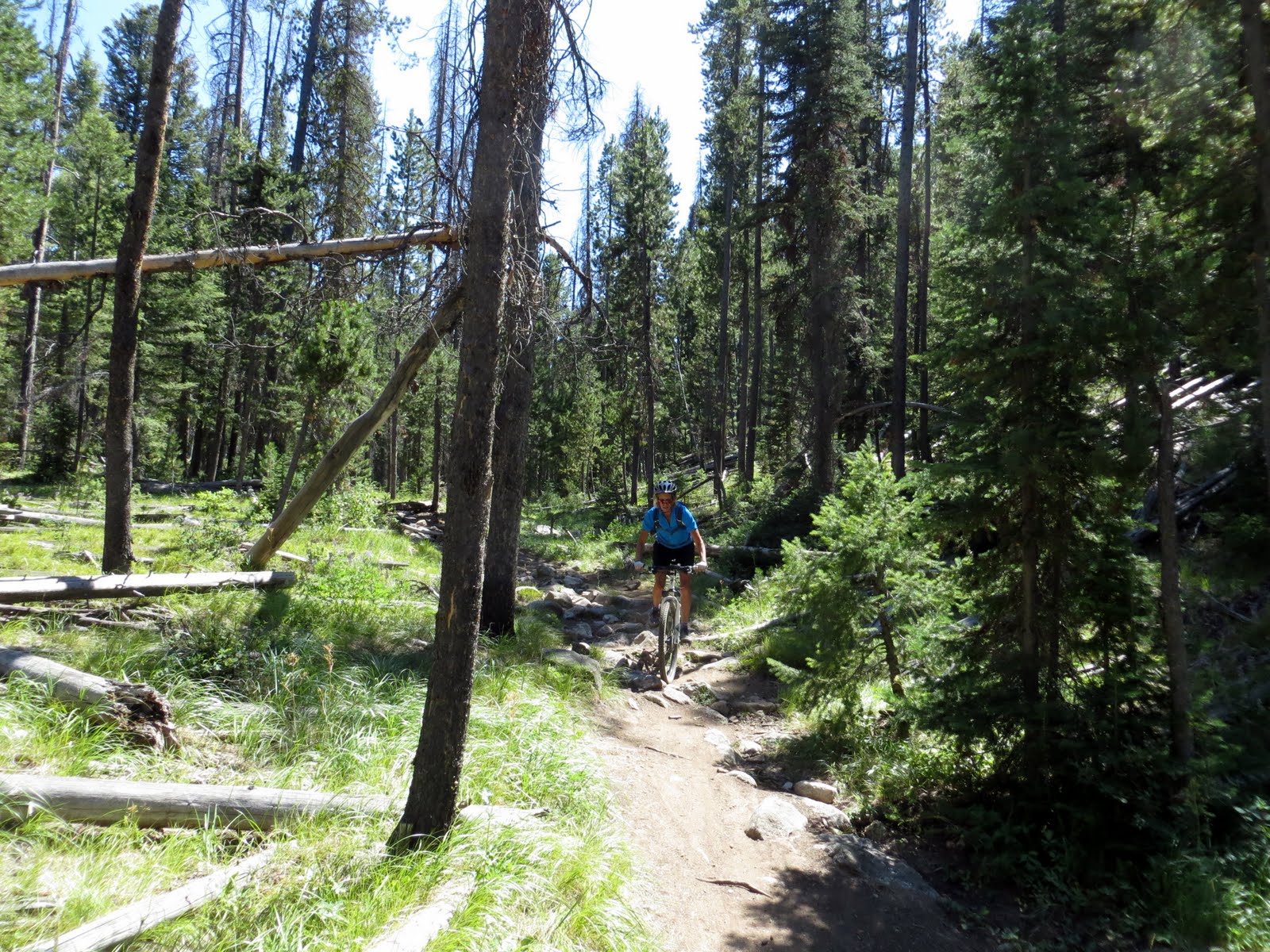
The guide book says that the single track trail includes "lots of baby head shaped rocks" and that caution should be exercised.  There were definitely baby sized head rocks all over the place.  These combined with large tree roots and an occasional downed tree provided a great technical ride contrasting the smoother Fisher/Williams Loop.

After a couple miles of rocky rutty single track we dropped out onto Elk Meadows where we cruised on smooth single track with an occasional mud hole thrown in to keep you awake.
 
The trail then gradually rose up the flank of Elk Mountain, past an old mine, and entered another large meadow that offered spectacular views of the Northern Sawtooths.
 

After this meadow it was back to a two track/gravel road for the bumpy ride back down into the Stanley Lake basin.  This 12 mile loop took us 2 hours to complete.  It was 4PM and we were spent.

There was a lot of sighing on the drive back into Boise.  What a day!

Blog Archive

Followers